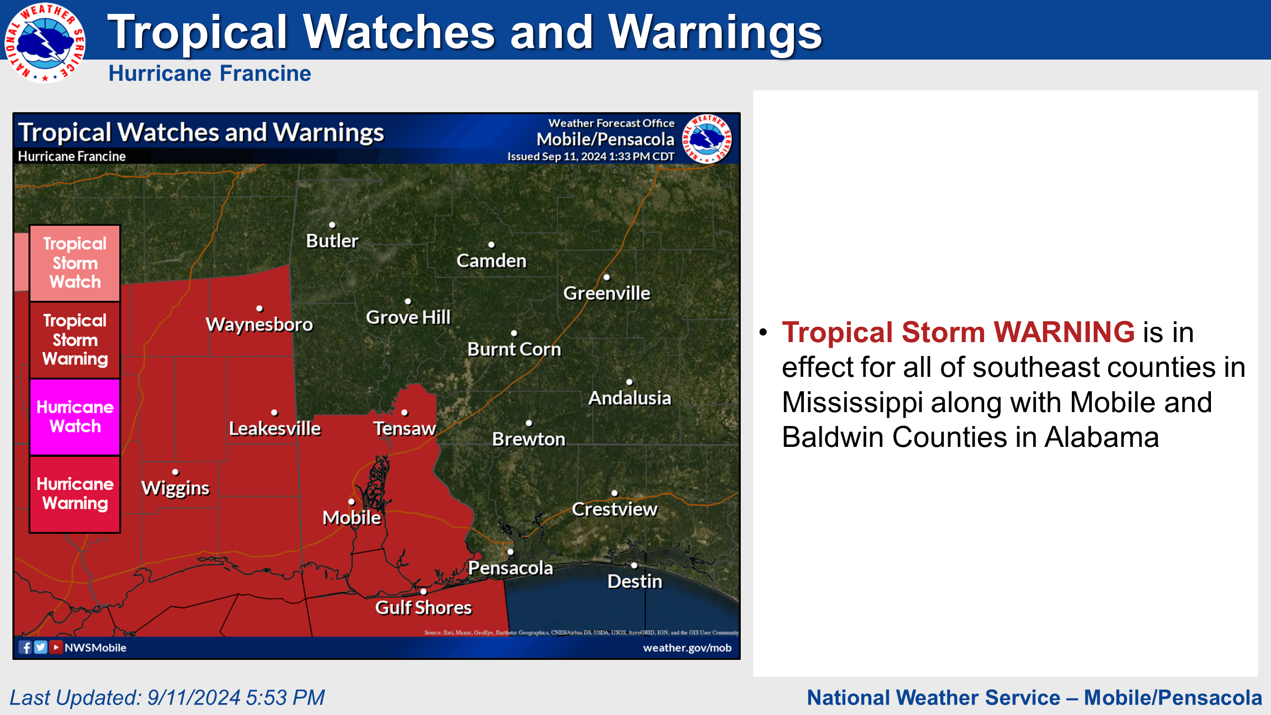
City of Gulf Shores officials are actively monitoring Hurricane Francine. As of 5 p.m. CST, the National Weather Service has placed Gulf Shores under a Tropical Storm Warning and a Coastal Flood Warning due to Hurricane Francine.
Francine's Track:
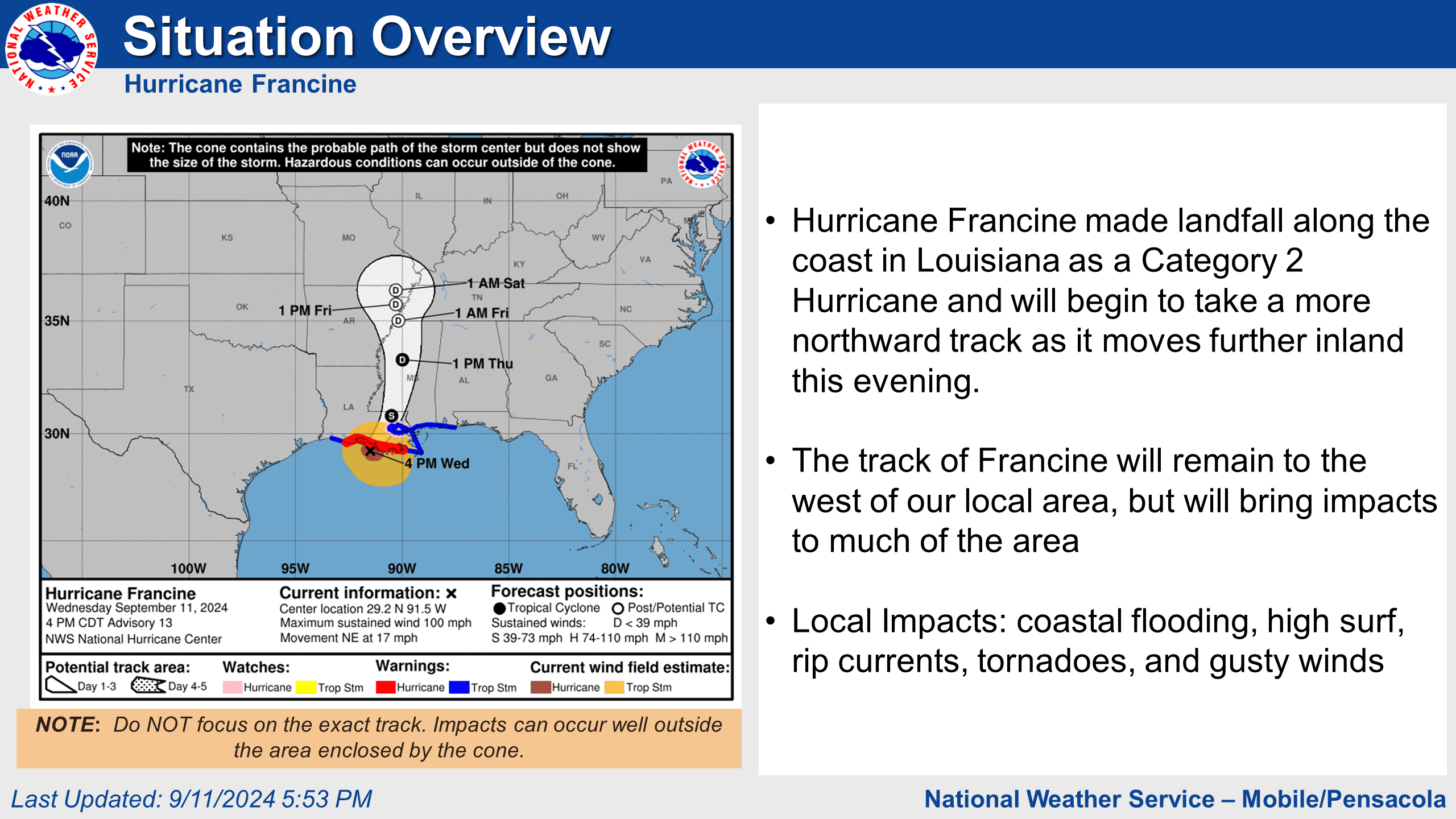
Francine made landfall along the coast of Louisiana as a Category 2 Hurricane. Francine's track will remain west of our local area but will impact much of it.
Local Impacts:
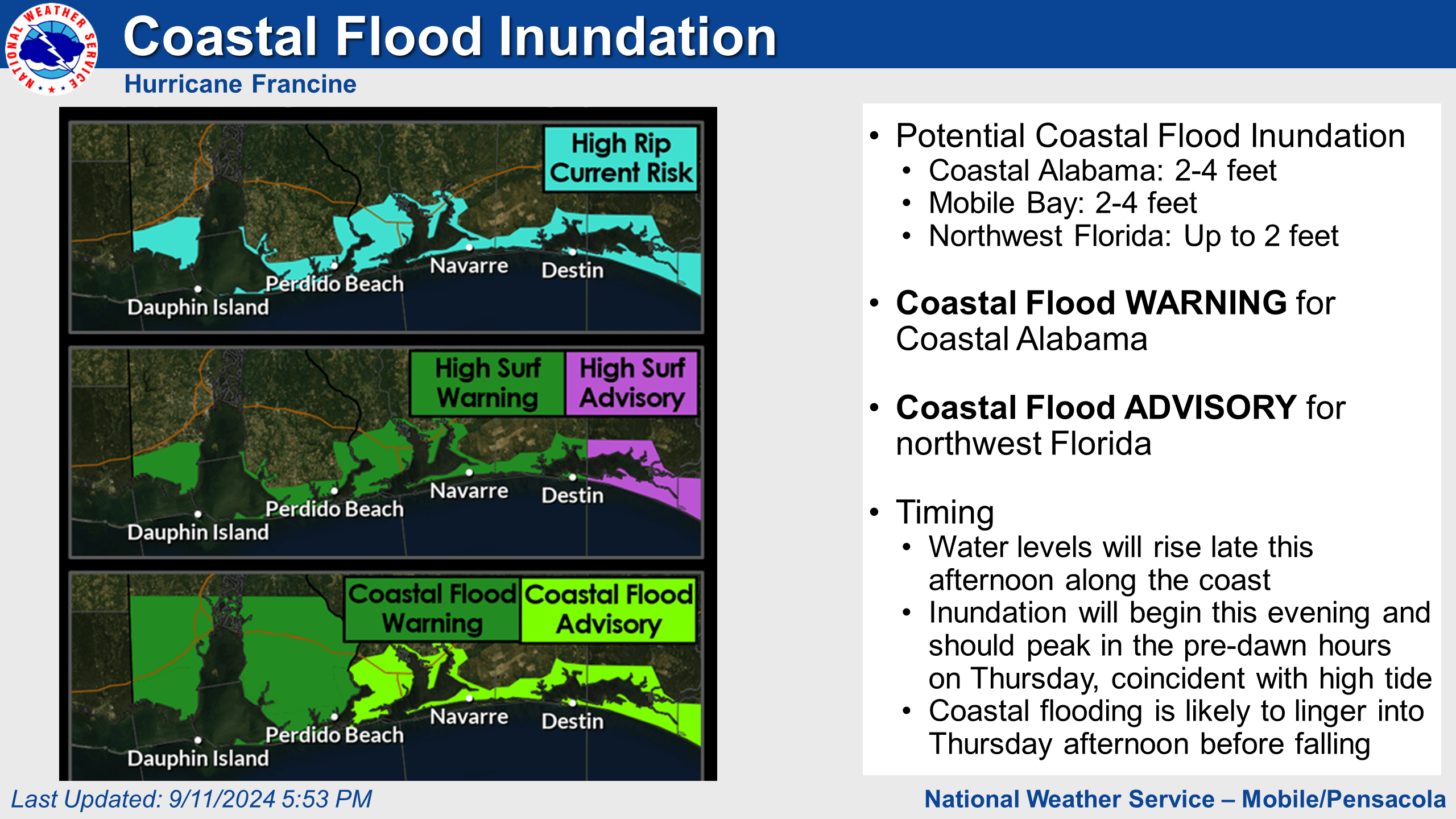
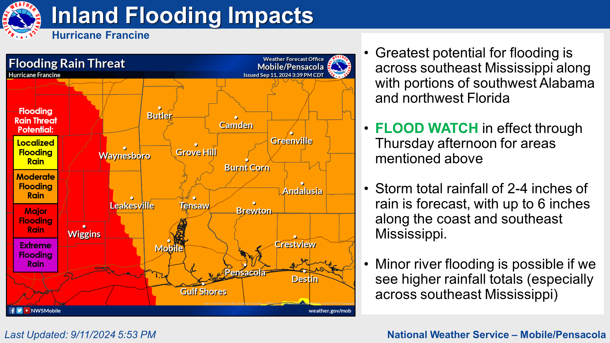
- Coastal Flooding - Confidence continues to increase that coastal flood inundation of 2-4 feet will occur along coastal Alabama, Wednesday night into Thursday morning.
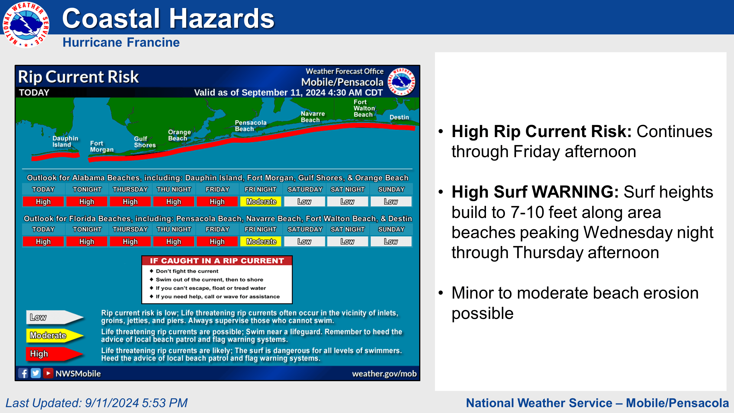
- High Surf & Rip Currents - Dangerous rip currents are expected along area beaches through Friday afternoon. Surf will build to 7-10 feet peaking tonight through Thursday afternoon. Minor to moderate beach erosion is also possible.
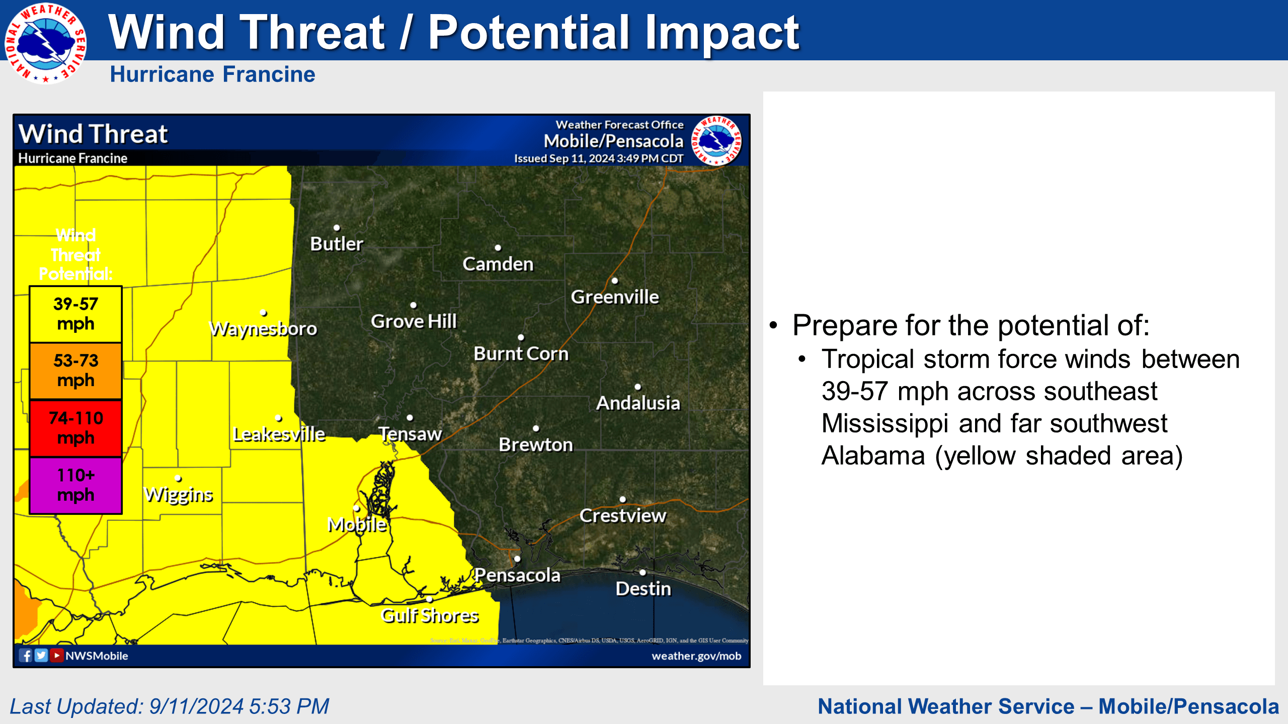
- Tropical Storm Force Winds - Prepare for tropical storm force winds (39-57 mph) across southeast Mississippi and far southwest Alabama.
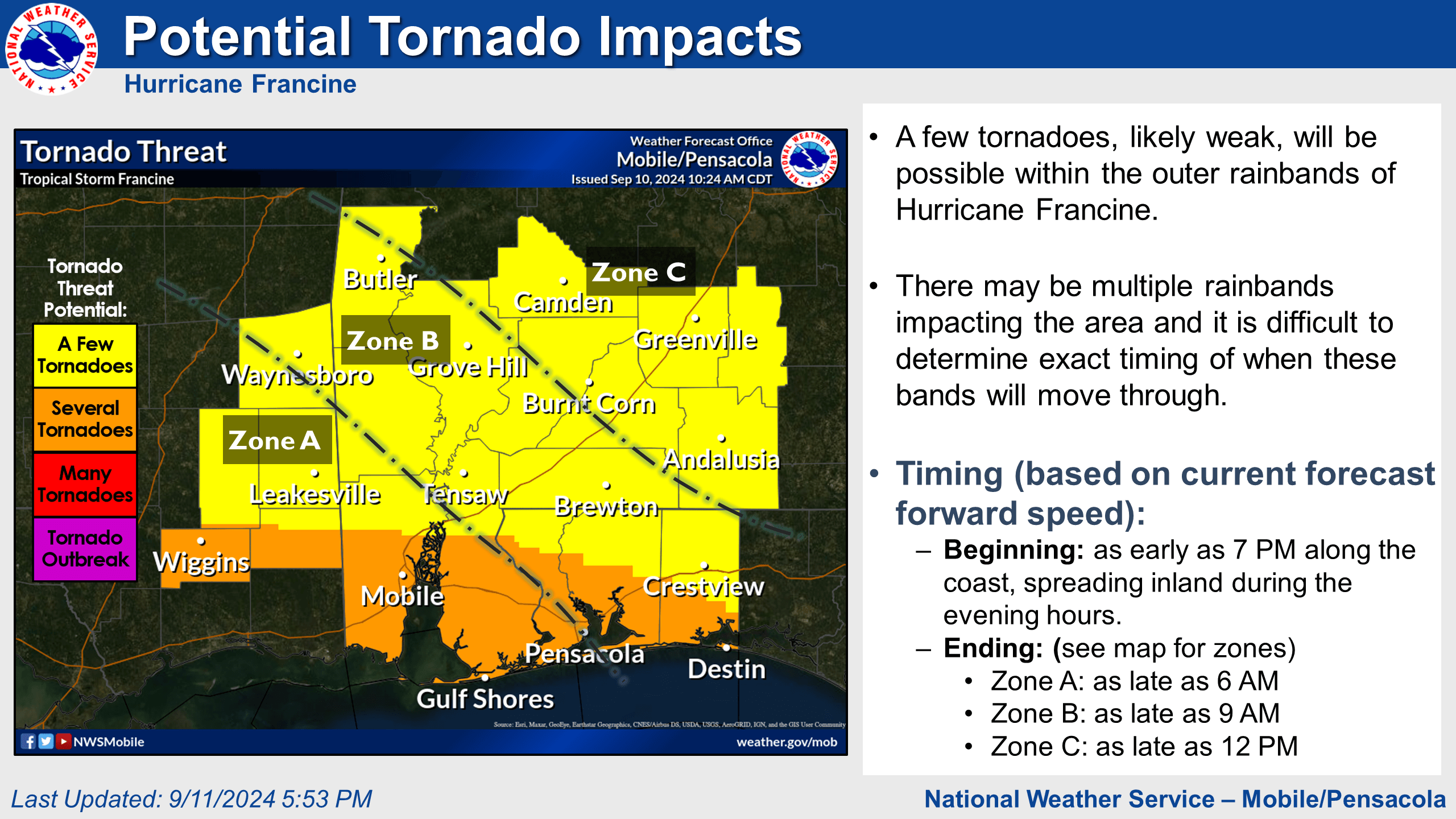
- Tornadoes - Confidence continues to increase on the potential for tornadoes across the entire area beginning as early as 7 p.m. and continuing through the mid to late morning hours on Thursday.
Safety First:
- Double red flags are currently flying at Gulf Shores beaches. Double red flags mean that WATERS ARE CLOSED to the public due to potentially life-threatening rip currents and dangerous surf. Those who enter the water will be subject to a fine and possible arrest.
- Turn around, don't drown. Never drive over flooded roads. The water may be deeper than it appears, putting you at risk of getting stranded.
Prepare now:
- Bring loose, lightweight objects (e.g., patio furniture, garbage cans, and bicycles) inside, and anchor objects that would be unsafe to bring inside (e.g., gas grills and propane tanks).
- Know your elevation to assess storm surge risk: check your elevation here.
- Ensure you have a current (2023-2024) Hurricane Re-entry pass.
- Prepare disaster kits with 7 days' worth of supplies. Consider multiple kits (home, car, workplace).
Stay Informed:
While Francine's track is west of us, our area will still face significant impacts. Don't wait – take action now to protect yourself and your property.